

the Rio Lempa
El Salvador is a small country in Central America, covering an area of 8,260 square miles. It is the smallest independent state in the region. The country is rectangular, measuring 60 miles wide and 160 miles long, contributing to its unique landscape. One of the notable features of El Salvador is its many rivers. There are about 350 rivers throughout the country, which are important for the environment and the economy. The biggest river is the Rio Lempa, which runs 250 miles from the north to the central part of the country. This river is significant because it is the only navigable river in the country, allowing transportation, agriculture, and fishing activities. The Rio Lempa is believed to have formed during the Pleistocene epoch, which was around 2.6 million years ago. This long history has shaped the land in El Salvador, creating fertile soil for farming and supporting various plants and animals. The river and its tributaries are home to a wide range of wildlife, including different fish, birds, and plants. Rivers in El Salvador are also significant to the people living there. They provide water for homes and farms and are used to create energy.

The Rio lampa towards the end
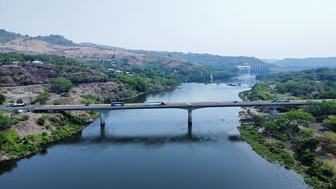
A bridge on the Rio Lempa

A dam on the Rio Lempa
“World Geography & Culture Online - Country Page.” Infobase.com, 2020, fofweb.infobase.com/wgco/Country.aspx?Page=1&iPin=M0019728. Accessed 10 Feb. 2025.
Cia.gov, 2025, www.cia.gov/the-world-factbook/countries/el-salvador/#geography. Accessed 11 Feb. 2025.
“The Lempa River: Central America’s Lifeline | LAC Geo.” Lacgeo.com, 29 Dec. 2024, lacgeo.com/lempa-river-central-america. Accessed 13 Mar. 2025.
Morgan, J. P. “A More Sustainable Future for El Salvador’s Lempa River.” Jpmorgan.com, J.P. Morgan, 2025, www.jpmorgan.com/insights/banking/investment-banking/el-salvador-debt-for-nature-transaction. Accessed 13 Mar. 2025.